
360° capture for cemeteries
Their loved ones rest with you. Help every family find their way back.
We capture your grounds — however many acres that is — and put your own records behind them. Families search a name from a phone two thousand miles away, see exactly where to walk, and stand at the right marker when they arrive.
Nineteen seconds
This is the walk we are trying to make possible.
A grandson at Mountain View. He scans the sign at the entrance, and it walks him to the row.
The daily reality
Your staff answers the same three calls every day.
Where is my mother buried. What are your hours. Can someone walk me out there. Every one of those is a person who could not find the answer online — because it was never put there.
The records exist
Most cemeteries already hold decades of interment records. They just live in a binder, a spreadsheet, or a system nobody outside the office can reach.
Families search anyway
They search your cemetery’s name and land on a third-party site full of ads and errors — one you do not control and cannot correct.
Distance is the norm
Families move away. A grandchild in another state still wants to see the grounds, read the marker, and leave a note.
What you get
Right now, families searching for your cemetery land on somebody else’s website.
360 Eternal puts the grounds, the records, and the search on a page that belongs to you. You decide what families see.
Search by name
A family types a surname and gets the plot, the section, and walking directions to the marker — from your records, not a stranger’s.
The grounds in 360°
Drone and ground-level capture, so someone who cannot travel can still see where their family rests and how the place is kept.
You hold the corrections
Families flag a wrong date; your office approves or rejects it. Nothing publishes without a person at the cemetery saying yes.
And then it can sell
Flowers placed on a grave for a family too far to visit. A plot held at eleven at night. Preplanning that starts before anyone books a meeting. Click through the demos.
What a capture produces
Your whole cemetery, measured and mapped.
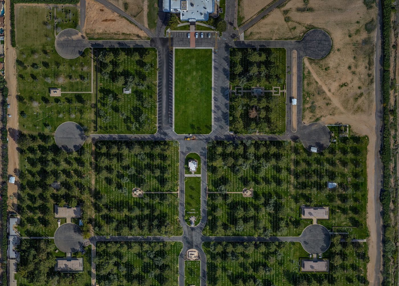
This is Mountain View in Mesa, flown and stitched in a single morning. Every section, every path, every marker — at a resolution where a family can pick out the row.
Underneath it sits the interment record, so a name typed into a search box resolves to a spot on this image.
How it goes
The capture is the predictable part.
We capture your grounds
Drone overhead, 360° cameras at ground level, section by section. A day or two on a small cemetery, longer on a large or busy one. No closures, and we stop for every service.
We map your records to it
Your interment list — whatever shape it is in — gets tied to real positions on the grounds. We do the cleanup.
Families find their way back
Your search goes live. You get the corrections queue, the photos families upload, and the numbers on who is looking.
If you run a cemetery
Start with a free listing, not a sales call.
It costs nothing, it takes a few minutes, and it puts your name, hours and phone number in front of the families already searching for you.
Families
Tell us where they rest, and we’ll ask.
If your family’s cemetery is not online yet, name it. We reach out to cemeteries that families ask for first — and we tell them who asked.